Mountain bike ride over Salter Fell, Forest of Bowland, Lancashire, England
 |
| The long and winding road over Salter Fell |
I wrestled the OS map to the floor and fully spread it over the carpet. It covered Lancashire’s Forest of Bowland region, and I was skimming over it seeking out potential rides for a sunnier day in the future. The wind and rain were doing their worst that August Bank Holiday afternoon. On finding the Hornby Road (Track) marked on the map I immediately thought that, on a bluebird-day, this would make for a fantastic day out on a suitable bicycle.
After a
little research it turned out that I had “discovered” an old drovers trail from
Hornby to Slaidburn and that it followed the route of the old Roman road from
Ribchester for much of the way. It also turned out to be a well-known route in mountain-biking
circles known as The Salter Fell Track.
Roll on five
or six years and in early June of this year (2020), on the last day of a warm
and sunny settled period of weather, I set out from Lancaster to ride over
Salter Fell to Slaidburn with the return leg of the journey via the Trough of
Bowland.
I was not
sure if I had the fitness to complete the trip that early in the year, but I
was determined to make the most of what
could be the last sunshiny day for a while, following a diet of shorter and much colder lockdown rides over
the previous two months. I had a mild bout of “the virus” in March and experienced
some after-effects that limited how much time I could spend a-wheel, but I had
been building mileage and getting much stronger more recently. I could really
have done with a few more weeks preparation could I not? It was a glorious day,
so I decided to go for it.
A few days
earlier I had ridden up into Roeburndale to recce the start of the ride and to make
sure that me, my lungs and my bicycle were up to the hefty climb on to High Salter.
My lungs were fine that very hot day, but my gears were slipping a few cogs on
the very steepest sections of road. In the ensuing days a drivetrain inspection
revealed no serious wear and tear so I gave it a thorough clean and tightened the tension on my gear
cable to hopefully keep the low gear in place when it was needed most.
The first
part of the outward journey was warm-up-pleasingly flat, following the Lune
Valley cycle path from Lancaster to Bull Beck. After a short stretch on the A683
Kirkby Lonsdale road I made the right-turn towards Wray/Bentham. The road
remained flattish here as it twisted its way towards the outskirts of Hornby and
the right-turn up Roeburndale Road. Here the road immediately kicked up steeply
and a series of seemingly ever steeper and longer climbs took me all the way up
to High Salter Farm. Luckily, in this direction, the steepest double-chevron-worthy
section is downhill, so that was my brakes well tested too. My gears were
behaving themselves now, so all was well. During this ascent I stopped several
times for the spectacular vistas across Roeburndale to the Dales; the three peaks
of Ingleborough, Whernside and Pen-y-ghent erupting with Yorkshire pride in the
spring sunshine.
 |
| The Dales erupt with Yorkshire pride |
On passing
through the farmyard at High Salter the tarmac ran out and the off-road
adventure began. Here the path was gravel in nature and made for easy riding on
chunky all-round tyres. At the farm I had noticed a stack of white gravel
bales, so it was clear that the track, at least this part of it, was routinely
looked after. Soon a young farmer appeared driving his quad bike along the
track in the opposite direction with a woolly-looking hitchhiker in the back. I
smiled and waved at him. He returned in kind, the farmer that is. The track was
flat at first but stretched out winding up over the fell in the distance. The
long and winding road over Salter Fell. The track also passes over Croasdale
and Catlow fells.
 |
| Looking back to the farm at High Salter |
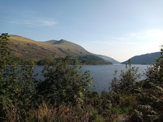
I knew I had a majestic day ahead of me with inspirational views across to the White Rose county in the East and the menacing Bowland ridge to the West with Ward’s Stone, the highest point in the Bowland fells, standing guard over the whole scene. A mountain rescue helicopter showed over the western ridge quartering Wolfhole Crag and Ward’s Stone before slipping away stealthily over Blanch Fell (after realizing that I was appropriately dressed and that my bike was up to the task in hand). My expectation chalice was overflowing as I recalled that soggy August afternoon a few years back spent scouring the map on my hands and knees, mesmerized by the concept and shear adventure of being able to ride a humble bicycle along such a fantastic route. Reality was exceeding the anticipation I had felt then and lived with all the time since. I was incredibly happy about that indeed.
As the route
approached the summit of Salter Fell, I stopped off at Grinding Stone Rocks to
rest up, eat a sandwich or two and take some time to completely max-out on the
surroundings. The course of the Roman Road feeds into the track near here,
veering off down the valley towards Wray in the North. My imagination was
running away with me but there was no sign of any Centurions or of their eponymous
road either for that matter. I could make out some cobblestones under the gravel,
but they looked like the Victorian type I have seen in nearby towns, but I am
not an archaeologist. The rocks provided welcome shelter from the cooling
breeze while I was stationary, but I couldn't resist climbing up on top to
take it all in…breath-taking. Views to stay alive for.
 |
| At Grinding Stone Rocks |
 |
| More rugged on the Ribble watershed side of the trail |
 |
| A series of gates are spaced along the track |
Another difference I noticed was the surrounding hillside: far fewer sheep and an abundance of heather. The other side of the gate was clearly sheep-farming country but here the land looked like it was set up for grouse shooting. I realised that in going through that gate I had crossed a great divide. That is, the becks were now feeding into the River Ribble whereas previously they headed for the River Lune.
 |
| The path more rugged |
I made my way carefully along this trickier part of the route, riding when I considered it safe to do so but quite often getting off to walk through a minefield of ruts, mud and boulders. I was mostly walking this section. Eventually I came to a point where another track led off to the west in the direction of Baxton Hill up to a smart-looking brick-building. I assumed this to be the hunting lodge used for the grouse shoots. The track improved after this point and I graduated to more bike riding than walking. Then, after some deceptively false flats, the track swept round and down, the Upper Ribble Valley coming into full view with the distinctive features of Pendle Hill in the distance on the far side of the delightfully luxuriant green pastureland. A squadron of RAF Hawk jets roared over the eastern flank, diverting my focus for a moment as they made a couple of all-too-short terrain-hugging, camera-defying passes of the valley. Mission accomplished.
The riding
was getting easier now and became really inviting when the harsh stones and
rugged channels were swapped for neat, ochre-tinged, earth-grey gravel that
looked as if it were formed from one hundred thousand smashed up plant pots all
laid down neatly, then steamrollered down especially for me and my bike. At the
top of this terra-cotta section a dutiful RSPB warden was parked up in his
wagon surveying the moorland, keeping a protective eye on the hen harriers,
lapwing, grouse and such-like. I felt I should stop and chat to him, but he was
obviously fully engrossed, tranquil and at peace with the surroundings, so I
let him be. On reflection I realize he would have almost certainly welcomed
genuine interest in his work. Next time.
 |
| On the trail of witches! |
I could relax a lot more from here and just enjoy the descent down to Slaidburn, passing marker posts for the Witches 400 trail confirmed I was on-track and before long I came across an unfamiliar sight…tarmac. It had taken two hours twenty minutes to complete the off-road crossing of the Bowland Fells. In truth the road that leads down Woodhouse Lane was also pretty-rugged; mountain-bike-worthy in itself, with much loose dirt-gravel covering the surface.
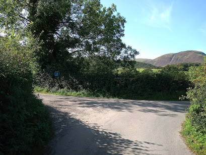
When I
reached the road junction I stopped to rest, get my bearings and take on some
vitals. Of course, what I really fancied was a well-earned pint of best, but it
was lockdown! I also took the opportunity to pump some air into my tyres for
the all-road journey home. Navigating was easy from here, I just had to follow
the sun! “Now it’s the warm down ride through the Trough of Bowland” I kidded
myself.
I cruised
the sublime, virtually car-free, lanes to Dunsop Bridge and then began snaking
up through The Trough itself. All was well for a while after a series of short-sharp
steeps and I stopped beside Langden Brook to snap photographs of the
exquisitely-picturesque-countryside. I had recently watched an episode of
Poirot (essential lockdown viewing!) in which I was sure the Trough of Bowland
delivered a BAFTA worthy performance, expertly doubling up for The Lake
District. Luckily, my memory bank had deselected the lengthy and steep Grey
Stone climb that marks the geographical boundary from the Ribble watershed over
into Wyresdale.
I struggled on that hill. My legs were fine,
but my cardiovascular system was not. I could not generate enough power, at
least not sufficient to maintain anything that may remotely be disguised as
speed. My right lung, still slightly immune-system-damaged after a suspected bout
of Covid-19* in March 2020, was straining to function on all cylinders, a
problem I had experienced more severely on less demanding rides a few weeks
previously. I climbed off and walked up to the top of Grey Stone, checking out
commemorative plaques to former cycling champion Bill Bradley (Tour of Britain winner
’59 and ’60) and “the legendary Jack Thompson”. Did they ride this on a 42/25 gear
ratio? I had done it from the other direction on 34/25 a few years before in a
sportive event (Forest of Bowland Sportive, April 2017). On this day I was
struggling on 28/30.
Happily, I
then had the sweeping, wide-grin-inducing descent into Wyresdale that gleefully
ate up the road, locating me a few miles from home with Tardis-like efficiency.
There were still a few hills to contend with, including Jubilee Tower and
Quernmore, so I made the pragmatic decision to walk all the up-hills from here
in. I was sure in doing that I would still be able to make it back in daylight,
all-be-it of the fading kind!
After over
eight hours on the ride and with half an hour of daylight to spare, I made it
back home; exhausted, exhilarated, slaked.
Hope it
rains next August Bank Holiday!
*(Okay I was
never tested; it was most definitely a nasty deep lung
affecting virus with long lasting side
effects…any offers?)

Comments
Post a Comment