Dirwnod dau: Taith feiciau Ynys Mon (2022)
 |
 | ||
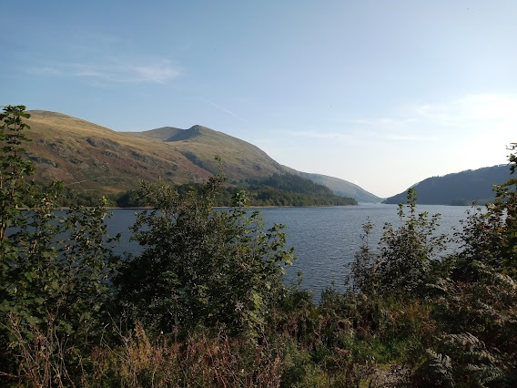
| The view across Red Wharf Bay from Nant Bychan. The sun was out next morning so I took a stroll down on the beach to take in the views across Red Wharf Bay and to admire some of the rock balancing art that was on display there. It gave me some thinking time and I decided to stay another night at Nant Bychan and to do a day ride inland and head towards Llyn Allaw and the northern part of the island.
Mid-morning I set off, free of most of the camping gear. It was a great feeling to be riding the bike unloaded, even though it was early in the tour. Later I realized that I had left the fuel bottle on the bike, which irked me a bit. After continuing on the main road for a short stretch I quickly peeled off onto the narrow, windy, rollercoaster lanes heading west in the general direction of Penrhoslligwy. I was following my nose but occasionally stopping at some farm gates to study the paper map I was carrying. I had it in mind that I would take a lunch stop at a picnic table overlooking Llyn Alaw but I had no fixed route to follow.  |

I kept riding west until I could see the outline of Holyhead in the distance; a spectacular view from the high ground in the centre of the island. At that point I turned north towards Llantrisant and then around the western side of Llyn Alaw.
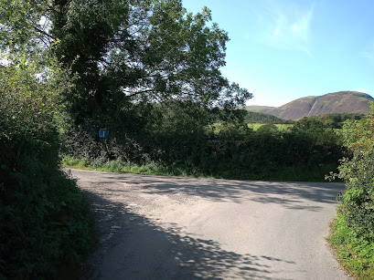
It is a large reservoir but I did not actually get to see much of Alaw itself, as the route I took had hilly terrain blocking the view to my right most of the time. I only got the occasional glimpse of the shimmering blue fresh water through a gap in the undulating landscape.
There was no obvious route to the lakeside either and it was still early in the day, so I continued on towards Rhosgoch but turned left for Cemaes Bay, via Llanfechell and Tregele, shortly after leaving the reservoir behind me. So my planned waterside picnic in the sunshine at Llyn Alaw had to wait for another day.
The lanes were all very quiet with only the occasional car for company. Anglesey is very lumpy and most of the time I was either pedalling uphill or downhill. Some of the lanes I was riding were part the national cycle network; NCN566 to be precise.
Route 566 is one of the three NCN routes that are to be found on Anglesey, the other two being NCN5 and NCN8 (NCN8 is coincident with EV2 being on the route to Ireland via the Holyhead ferry).

On arriving at the quaint seaside town of Cemaes Bay, the most northerly town on the island, I checked out for a place to stop and found a nice looking cafe at the end of at main street right where the road down to the beach runs off, it's called Y Gloch (The Bell) and very nice it is too. It made a good substitute for a picnic at the reservoir.
So after a very pleasant twenty five minutes watching the bucket and spade world go by from the cosy cafe, I made my way back onto the main road and took the first right turn back along the little lanes of the interior heading towards Rhos-goch.
I had made sure that my route took me down to the glorious beach, where I did stop to smell the seaweed and to listen to the cackling of the chip-stealing gulls and the sandcastle-building children. Perfect harmony.
 |
| The beach Cemaes Bay |
I criss-crossed the lanes and eventually worked my way onto the main road that runs north-south through the island (B5111). I had come out at the junction on the south-side of Parys Mountain.
My route back to Moelfre was just ahead on the southern side of the hill(L at T then R it would say on an audax route sheet) but I couldn't miss the opportunity to climb up to the top of Parys Mountain, a place that is not quite like anything on Earth; it could easily double for Mars or Jupiter and in fact has been used as a film and TV location.
 |
| Life on Mars? There is copper at Parys Mountain. |
I looked up the shows filmed there but they are not ones I'm familiar with. It is a working copper mine but there is public access to some of it as it is also a tourist attraction, a bit like the slate mine at Honister in The Lake District. Copper has been mined at the site since the Bronze Age over four thousand years ago.
|
| Next to the Parys Mountain copper mine near Amlwch. |
After stopping for a while to gawp at and to photograph the Martian landscape atop Parys, I dropped back down the same way I had come up and then immediately turned left to start the return leg back to Moelfre. I took a direct route across to the main road (A5025) near City Dulas and then covered the last few kilometres back towards camp.
Day 2 route: Circular tour of northern Anglesey from Nant Bychan via Llyn Allaw, Tregele, Cemeas Bay and Parys Mountain.

Comments
Post a Comment